Maps of John Hampden Bingley’s WWII route through France and Belgium, June to September 1944
Between June and September 1944 Jack took photos of his journey through France and Belgium as the Allies gradually defeated the German army in Europe (see the photos by clicking here). Below are two maps summarising the military action and showing the locations of Jack’s photos.
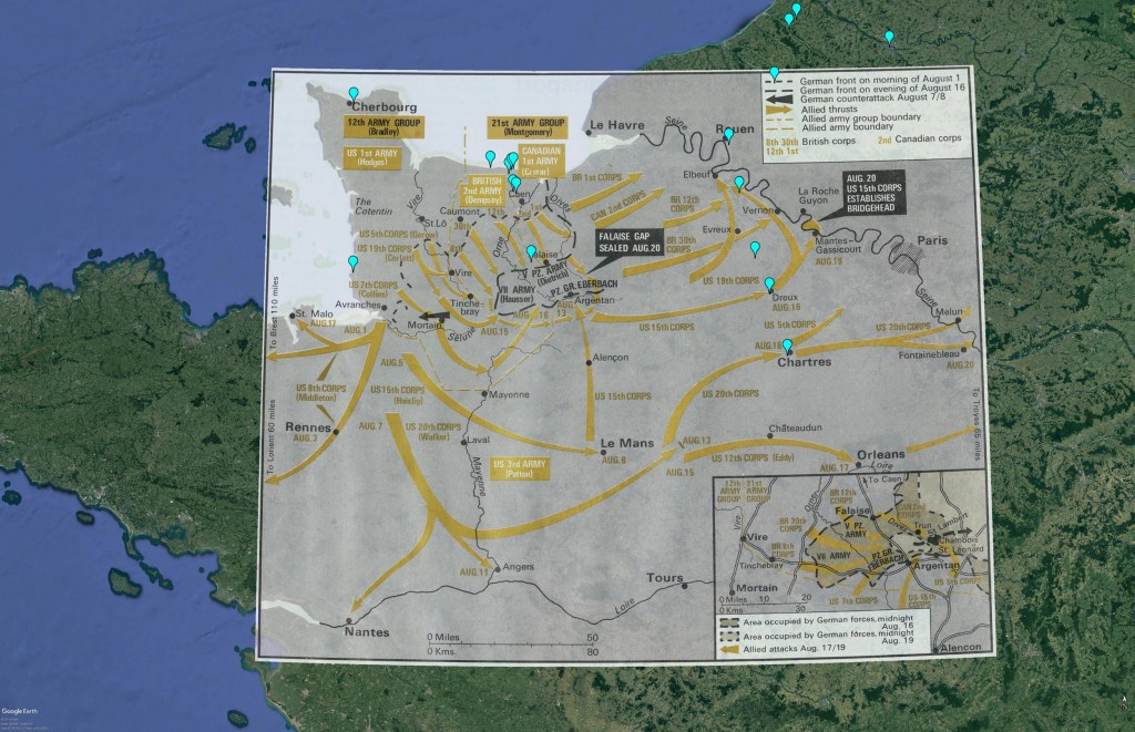
Map 1: WWII military action in August 1944 and locations of Jack’s photos – Falaise and the Seine

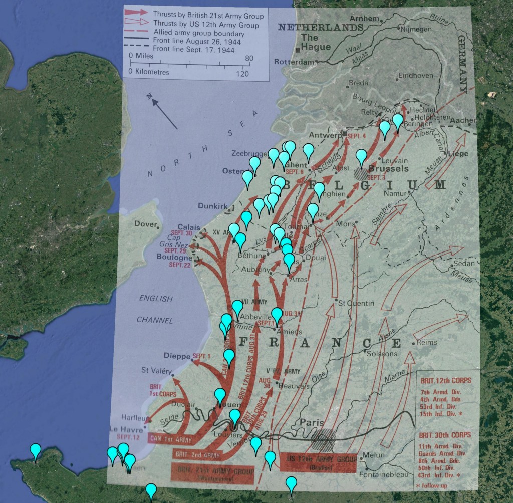
Map 2: WWII military action in August and September 1944 and locations of Jack’s photos – Northern France and Belgium
© Caroline Maskill, New Zealand Family History Search
April 2021
